JSI RESOURCES: Publications

GIS @ JSI: Using GIS to Optimize Delivery Systems in Tanzania

SHARE THIS

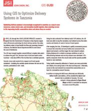
This marketing piece examines how JSI brought together several different complex data points improve the efficiency of the Tanzania health supply chain direct delivery system. Using the data collected from delivery trucks’ GPS devices, the JSI team was able to map the secondary road network across the entire country. JSI also calculated travel speeds on paved versus dirt roads—including the variable speeds between the wet and dry seasons. Today, health commodity deliveries in Tanzania are more predictable and reliable, thus saving funds in the short and long-term. Ultimately, access to this road network has ensured that commodities are on hand for communities around Tanzania.

In addition to helping the MSD more effectively and efficiently deliver health commodities, JSI has doubled the digital road network that is available in Tanzania. The road network is being uploaded to Open Street Maps so that it is available for everyone to access around the globe. JSI, 2015.

Partner with Us

We strive to build lasting relationships to produce better health outcomes for all.